
How does global warming affect the maritime shipping industry? How do ocean changes affect the movement of military vessels, the migration of whales, and the dispersal of oil spills and plastics in ever-shifting currents?
These were some of the questions addressed last Thursday at an Earth Day Ocean Intelligence Forum. The event was hosted by Sofar Ocean, a San Francisco-based technology company that builds and disperses hundreds of remote, solar-powered data collection buoys across the world’s oceans.
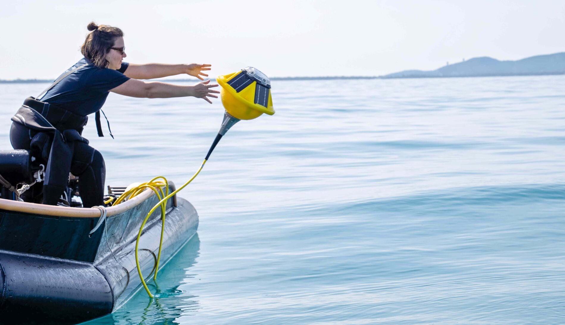
“We’ve thrown them out of planes, we’ve thrown them off of the backs of recreational yachts, any way we can get them out there,” Sofar founder Evan Shapiro said. “We’ve turned piles of hardware into piles of data all over the world.”
The 10-year-old company has a network of about 800 yellow data collection devices.
“What we’re trying to build is the world’s largest ocean intelligence platform,” Shapiro said.
Like satellites in space, the buoys are self-sustaining transmitters. They can be rigged with whatever scientific gadgets their clients wish to use. A variety of devices can be plugged into them with the same type of HDMI dongle used for a TV monitor.
Below the surface of the water, they dangle like high-tech jellyfish, sucking up information about the great blue unknown — changing sea levels, current direction, temperature, salinity and sound. It is all transmitted to a dashboard through a relay of surface vehicles and satellites.
“You click in whatever thing you want, and you translate it into something that then can be temporally and spatially available,” said Dan Breyre, head of product at Sofar Ocean. “If it’s environmental DNA (genetic material shed by organisms), if it’s acoustics, if it is turbidity, it doesn’t matter. Whatever is valuable to you — whether you’re an aquaculture farm or a port — we are just the rails that you ride.”
The devices, which were arrayed around Sofar Ocean’s office at Embarcadero Pier 28, were the anchor point for a panel discussion. The topic, “ocean intelligence,” addressed the growing trend of data collection by anyone that goes to sea.
The utopian vision would be for all that data to somehow be standardized and shared throughout the world, for free maybe. Nonprofits, government agencies and scientists could all work together to help clean the ocean and improve the health of the Earth’s most valuable ecosystem.
“When GPS was developed, it had a specific purpose,” said Bill Sherrod, associate director of Hopkins Marine Station in Pacific Grove, Stanford University’s marine laboratory. Global positioning systems eventually opened for broader uses across various industries, he said.
Recommended for you
“There’s still a national security component that has greater precision, greater fidelity,” he said, referencing the different levels of detail available for the public and different subscribers. Sherrod said the future needs more collaboration.
“Bringing together a for-profit, a startup, a government,” he said. “We do it, but we do it somewhat ad hoc — a little bespoke, I think, is a way to describe it — but having this concerted effort will help to understand the ocean.”
Fossil fuel emissions have made our planet less shiny. Due to increasing greenhouse gas concentrations in the atmosphere, the Earth is now reflecting less sunlight back to space.
Trapped warmth has caused ocean temperatures to reach record highs over the past decade, according to the National Centre for Earth Observation, an international organization that uses satellite and remote sensing data to track the planet’s health.
Satellites are the main tool for nonprofit environmental watchdog SkyTruth, which monitors the sea from space to locate oil spills or illegal fishing and reports it to enforcement agencies.
“When I’m talking with Coast Guard in the Philippines, they are struggling to navigate all the different tools that are available to them,” SkyTruth’s Mitchelle De Leon said.
“By the time our detections reach the end user, the shipping vessel that likely polluted their waters has long left. So the resource manager or the enforcement agency is not able to deploy their assets in time.”
Firuze Gokce, with the nonprofit BayQuest, uses the Sofar Spotter Sound audio recording device in San Francisco Bay to locate migrating whales and study the impact of vessel noise on whale behavior. In one of their field trips, they found an entangled humpback whale and were able to contact rescuers to free it.
“Our aim is to be able to ships slowdown in the San Francisco Bay area,” Gokce said. Having the locations of each acoustic recording can be fed into models for whale highways that appear on the dashboard of the ship operators.
According to Sofar Ocean’s founder, the company has a forecast simulation model that can beat the National Oceanic and Atmospheric Administration’s. It is used by the container cargo industry to find the most fuel-efficient shipping routes.
“The area we’re trying to observe has so many unknowns and is so difficult,” said Breyre. “No shade to people that are in space, but the ocean is the hardest place to send things. You can’t just walk out and go pick it up. There’s not an ocean that we don’t have devices in, but the ocean is massive.”


(0) comments
Welcome to the discussion.
Log In
Keep the discussion civilized. Absolutely NO personal attacks or insults directed toward writers, nor others who make comments.
Keep it clean. Please avoid obscene, vulgar, lewd, racist or sexually-oriented language.
Don't threaten. Threats of harming another person will not be tolerated.
Be truthful. Don't knowingly lie about anyone or anything.
Be proactive. Use the 'Report' link on each comment to let us know of abusive posts.
PLEASE TURN OFF YOUR CAPS LOCK.
Anyone violating these rules will be issued a warning. After the warning, comment privileges can be revoked.