Sea surface temperatures have warmed up in the central equatorial Pacific Ocean over the past month and the National Oceanic Atmospheric Administration declared El Niño is here — but only time will tell if this winter will be wetter or drier.
Typically, strong El Niño years led to wetter and rainier winters, like the record rainfall in 1982 and 1997, according to the Water Education Foundation. This summer should be warm, but that isn’t due to El Niño. It’s rather part of a separate trend of warmer summers. La Niña weather patterns, which we experienced this winter, are typically drier but that’s not always the case, which was proven when the Bay Area received historic amounts of rain. However, NOAA climate scientist Tom DiLiberto said a weaker El Niño is already here but scientists will know more about its impacts on weather in late July or August.
“The declaration of the El Niño advisory is just the beginning as scientists will continue to unpack information as it comes,” DiLiberto said.
The El Niño event is weak as of now but, by peak winter, there is a 56% chance it becomes strong. While that sounds like a coin toss, and it nearly is, DiLiberto said that number is fairly high. There are not that many El Niño events reaching that strength since 1950, DiLiberto said.
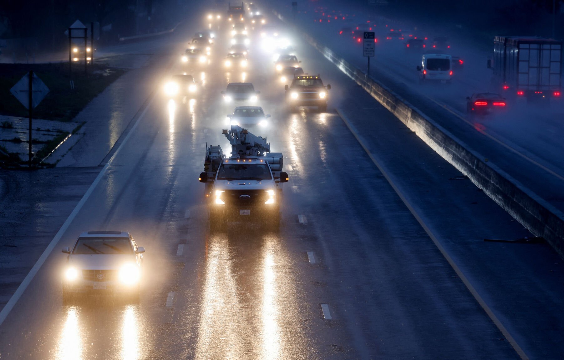
That all means, if it rings true, the county could be in for another wet winter.
The phenomena of both El Niño and La Niña weather patterns date back hundreds of years to Peruvian fishers who noticed a change in the water temperature and humidity in the air. It had a direct correlation on the abundance of anchovies they would catch. In Spanish, El Niño translates to little boy, meaning baby Jesus, because the weather phenomenon generally happens around Christmas. The warm surface water affects fish that eat phytoplankton. The warmer waters can also bring tropical species, like yellowtail and albacore tuna, into areas that are normally too cold, like Southeast Asia, according to the NOAA.
During an El Niño weather pattern, trade winds tend to weaken and warmer surface water pushes toward South America fueling an intensification and shift on the jet stream. The warm water triggers the thunderstorms in the middle of the ocean to activate, which means a wetter and stormier winter for the county.
Recommended for you
Think of the jet stream like a fire hose, DiLiberto said, a person standing under a fire hose will be soaked, and the same goes for the jet stream, which could be influenced by El Niño and it ultimately will determine the amount of rain the county will see over winter.
“The stronger the El Niño event means it will have more of an influence on the weather system than if it’s weaker, and that’s because many factors go into the weather system,” DiLiberto said.
To declare an El Niño event, there are multiple factors, sea surface temperatures along the equatorial Pacific Ocean, trade wind patterns and climate models predicting those numbers will be sustainable over time.
NOAA tracks the surface temperature along the equatorial Pacific Ocean. When temperatures are more than .5 degrees Celsius warmer than the long-term average, which is data tracked from 1991 to 2020, it’s one of three factors that indicate El Niño is likely to occur. Results from data showed the sea surface temperatures in the tropical Pacific Ocean in May were .5 degrees Celsius above the long-term average. And just last week, the agency recorded temperatures .8 degrees Celsius above the long-term average. May wasn’t a blip and the temperatures have been rising since then, DiLiberto said.
The second factor is the expectation the ocean temperature will last for five consecutive seasons. NOAA computes seasons in three month groupings, he added. And its climate models predict those numbers to be easily reached over that time frame. The last factor is when there is increased precipitation in the Pacific and a weakening of the trade winds, which both have occurred, he added.
El Niño last came in 2018 but it was weak. El Niño typically lasts around nine months but can last up to two years, in some instances. On average, it occurs once every seven years and is generally followed by a La Niña event the following year, Warren Blier, National Weather Service science officer, said.
Keep the discussion civilized. Absolutely NO
personal attacks or insults directed toward writers, nor others who
make comments. Keep it clean. Please avoid obscene, vulgar, lewd,
racist or sexually-oriented language. Don't threaten. Threats of harming another
person will not be tolerated. Be truthful. Don't knowingly lie about anyone
or anything. Be proactive. Use the 'Report' link on
each comment to let us know of abusive posts. PLEASE TURN OFF YOUR CAPS LOCK. Anyone violating these rules will be issued a
warning. After the warning, comment privileges can be
revoked.
Please purchase a Premium Subscription to continue reading.
To continue, please log in, or sign up for a new account.
We offer one free story view per month. If you register for an account, you will get two additional story views. After those three total views, we ask that you support us with a subscription.
A subscription to our digital content is so much more than just access to our valuable content. It means you’re helping to support a local community institution that has, from its very start, supported the betterment of our society. Thank you very much!


(0) comments
Welcome to the discussion.
Log In
Keep the discussion civilized. Absolutely NO personal attacks or insults directed toward writers, nor others who make comments.
Keep it clean. Please avoid obscene, vulgar, lewd, racist or sexually-oriented language.
Don't threaten. Threats of harming another person will not be tolerated.
Be truthful. Don't knowingly lie about anyone or anything.
Be proactive. Use the 'Report' link on each comment to let us know of abusive posts.
PLEASE TURN OFF YOUR CAPS LOCK.
Anyone violating these rules will be issued a warning. After the warning, comment privileges can be revoked.