This photo shows the extensive wetlands that were formed by Islais Creek (Looking east across the wetlands toward Hunters Point and Bayview from Highway 101).
Photo courtesy of the San Mateo County History Museum
San Francisco’s ever persistent population march to its southern and western borders spelled the death knell for the most extensive open-water creek that existed in San Francisco. Today, virtually none of its surface is visible, although it drained the south and east slopes of Mount Davidson, the three hills of Diamond Heights (Red Rock, Gold Mine and Fairmount Hill) as well as the southern area of Twin Peaks. It was a massive drainage system that was almost a river and supported an extensive freshwater riparian habitat that existed in the area from Highway 101/Interstate 280 interchange to the saltwater tidal marsh to the east. The diverse habitat supported an abundance of fish, crustacean and millions of shorebirds. For thousands of years, the vegetation that covered hills of Mount Davidson and Twin Peaks supplied food and sustenance for herds of elk, deer, bear and communities of skunks, raccoon, opossum and garter snakes.
When scientist George Davidson mapped the mountain named for him, he called it Blue Mountain due to the color of the wild flowers that grew there. He was able to view the tributaries of the Islais Creek that flowed on the north side (Miraloma) and on the south side of the mountain. In 1891, the Islais and Salinas Water Company (later the Spring Valley Water Company) began tapping the Bethlehem Spring that produced 200,000 gallons of fresh water for use.
A principle collector and conduit for the Islais Creek was the Glen Canyon (called Rock Gulch at first) that channeled much of the water to the southeast and toward the Bay. The well gouged out, relatively flat canyon that formed on its journey toward the Bay afforded a much sought after site for many of the transportation systems (such as the San Francisco and San Jose Railroad, the Ocean Shore Railroad and the No. 40 Trolley Line as well as other trolleys) and that was to develop to serve the people transportation along the Peninsula. The fresh water in the creek became an unfortunate victim in the struggle to improve the transportation systems in this area and, by the 1970s, the creek was put in culverts and covered up with dirt in the final episode of building the interstate from Highway 101 to Daly City.
Much of the flow of water was slowed due to the abundance of native grasses and iris on the land next to the creek. A dynamite factory was erected here next to the creek but it blew up in 1869. The Good Brothers Dairy grazed cattle next to the creek in the 1800s. It wasn’t long before developers had opened the Mission Zoo in 1898 complete with wild animals, tightrope walkers, balloon ascensions and a red barn that offered dancing. At the intersection of Diamond and Chenery streets, a streetcar trestle was erected and potential land buyers were offered transportation to view the Sunnyside Land Company development that Behrend Joost was offering to people from the inner city. Joost used the water from the Islais for his boilers that generated electricity on which his streetcars needed to run.
Concrete culverts were laid down to channel the creek through the canyon in the 1930s and a recreation center was built in 1937 under the Works Progress Administration. In the 1930s, O’Shaughnessy Boulevard was constructed. In 1928, the Islais Creek that flowed through the canyon that led to the marshes east of Highway 101 was being forced into storm drains and Alemany Boulevard was constructed. The Islais Bay was crossed by the Southern Pacific Railroad in the early 1900s and the marshes were assaulted by dirt haulers. The 1906 earthquake produced a lot of debris and it was hauled here by trucks and a train and used as landfill. The land became prime property for industrial development and the Islais Creek was funneled through culverts, to empty into the Bay at Third and Islais streets north of Hunters Point. Due to construction of streets, housing, parking lots and loss of vegetation for these things, the once mighty Islais Creek no longer exerts an important role in the lives of the communities of San Francisco.
Ironically, south of Woodside, the small hilly/wooded community of Portola Valley has decided to “daylight” 650 feet of the south/north Sausal Creek that has been culverted. Recent study of creeks in cities and towns show that we may have acted too quickly when many of our waterways have been covered over. The water has little to impede their flow and causes flooding that could be avoided without the culverts. Much-needed water tables have been lowered due to culverting and many animals that have been a benefit to the communities have left the area where a habitat for their survival is essential. It seems that we may have acted too fast in our race for progress and need to rethink the benefits that creeks like the Islais may have on our quality of life.
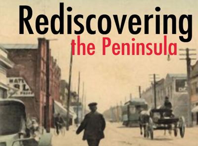
Rediscovering the Peninsula runs every weekend. It is compiled through our archives created by Jim Clifford and the late Darold Fredricks.
Keep the discussion civilized. Absolutely NO
personal attacks or insults directed toward writers, nor others who
make comments. Keep it clean. Please avoid obscene, vulgar, lewd,
racist or sexually-oriented language. Don't threaten. Threats of harming another
person will not be tolerated. Be truthful. Don't knowingly lie about anyone
or anything. Be proactive. Use the 'Report' link on
each comment to let us know of abusive posts. PLEASE TURN OFF YOUR CAPS LOCK. Anyone violating these rules will be issued a
warning. After the warning, comment privileges can be
revoked.
Please purchase a Premium Subscription to continue reading.
To continue, please log in, or sign up for a new account.
We offer one free story view per month. If you register for an account, you will get two additional story views. After those three total views, we ask that you support us with a subscription.
A subscription to our digital content is so much more than just access to our valuable content. It means you’re helping to support a local community institution that has, from its very start, supported the betterment of our society. Thank you very much!


(0) comments
Welcome to the discussion.
Log In
Keep the discussion civilized. Absolutely NO personal attacks or insults directed toward writers, nor others who make comments.
Keep it clean. Please avoid obscene, vulgar, lewd, racist or sexually-oriented language.
Don't threaten. Threats of harming another person will not be tolerated.
Be truthful. Don't knowingly lie about anyone or anything.
Be proactive. Use the 'Report' link on each comment to let us know of abusive posts.
PLEASE TURN OFF YOUR CAPS LOCK.
Anyone violating these rules will be issued a warning. After the warning, comment privileges can be revoked.