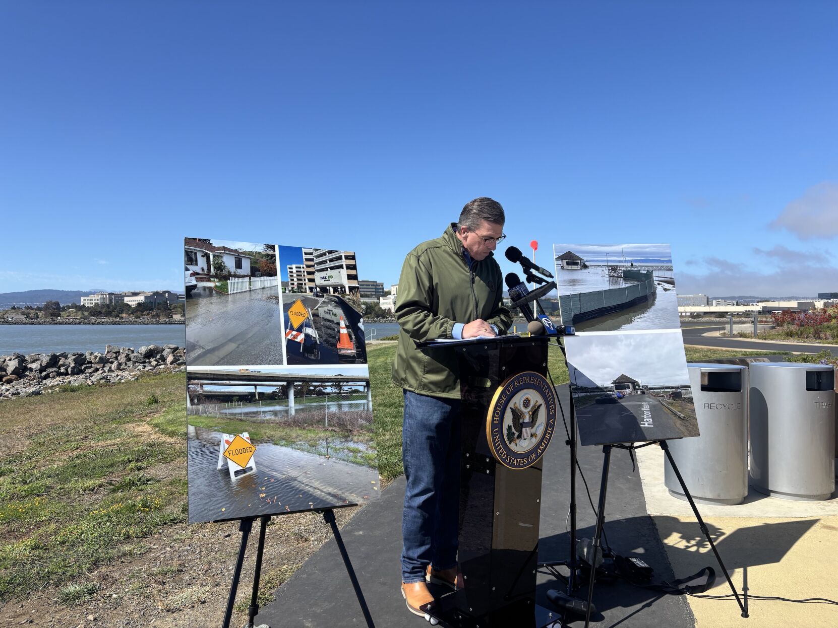
The threat of groundwater rise is posing increasing threats to coastal communities and infrastructure, U.S. Rep. Kevin Mullin, D-South San Francisco, warned at a press conference introducing legislation that would map, forecast and study the phenomenon and develop mitigation strategies.
“We know that climate change is going to cause water levels to rise, but there’s more to this challenge, and the truth is it’s mostly hidden from plain sight until it’s too late,” he said at the press conference July 29. “There is groundwater under our feet, and as the ocean moves inland, it’s pushing more and more water up.”
Amidst Trump administration attacks on climate science and environmental agencies, Mullin is focused on making the bipartisan legislation — co-authored by Rep. Andrew Garbarino, R-N.Y.— as tangible and practical as possible.
“Climate change gets tossed into a partisan bucket, even though we all know that the science exists, but we’re talking about infrastructure. We’re talking about economic impacts, and clearly there are blue states and red states impacted by what we’re talking about here today,” he said.
Groundwater rise is a more subtle and relatively understudied aspect of climate change where water slowly infiltrates soil and ultimately rises to the surface.
As sea levels continue to rise and storms become more severe, millions of people and trillions of dollars in infrastructure and property are at risk from rising groundwater, which can worsen flooding, corrode sewer pipes and spread toxic chemicals, Mullin said.
Because the possibility of such risks need more study for communities to properly protect against them, Mullin’s legislation — dubbed the Groundwater Rise and Infrastructure Preparedness Act — would direct the U.S. Geological Survey to map future groundwater rise and its public health risks.
Areas like the Oyster Point Marina in South San Francisco, where the press conference was held, are vulnerable to the phenomenon, which could extend up to 3 miles inland, OneShoreline CEO Len Materman said.
Recommended for you
“When we think about these issues of too much water coming over the Bay. It’s not just what’s coming over the shoreline … it actually is a bit more pernicious and subtle, because it goes farther inland, and we can’t, at this point yet, judge that,” he said. “That’s one of the reasons we need this bill.”
OneShoreline, a San Mateo County agency dedicated to addressing sea-level rise, could use the more detailed data generated by USGS to include groundwater threat preparedness in its planning, Materman said.
“Think of it like you’re planning a project to protect the foundation of your home,” he said. “Would you want to use countywide data on soil and aquifers, or data that is specific to your street?” he said. “We need more detailed information to design these remedies for groundwater rise.”
Many communities susceptible to groundwater risks aren’t even aware of the threat, said Sujata Srivastava, chief policy officer for SPUR, a Bay Area research and urban planning association. New research shows that East Palo Alto, for example, has more than 50 contaminated sites — 30 of which are within areas where groundwater is only 6 feet from the surface.
“These same vulnerabilities are common in many low-lying Bayshore communities,” she said. “A major problem is that many communities are unaware of their risk.”
The actionable plans for climate resilience that legislation like Mullin’s could facilitate is a necessity for Bayshore communities, including for South San Francisco, Mayor Eddie Flores said.
“It fills the knowledge gaps, directs the research and empowers local governments like South San Francisco to understand the threat and respond with precision and with purpose. We cannot protect what we don’t fully understand,” he said.
It's all well and fine to study the risks. But there are areas where we already have known and repeated groundwater rise along the bay, and cities are ignoring the clearly demonstrated risk. In Redwood Shores the City is seriously considering a development of 3 million square feet of 8 story buildings for bio-labs on top of a former toxic dump that floods with groundwater every winter. And being located on a wildlife preserve at the bay shore this risks contamination of the entire bay. Please, Kevin Mullin, help us wake up our City officials to the already known clear and present dangers, and enact policies to forbid building on these sites.
Groundwater rise and fall is controlled in the Netherlands with drainage channels and pumps. No need to panic. They have dealt with this for hundreds of years and do not pay attention to "chicken-littles." Now remember, Kevin needs grist for his political aspirations. That is his ulterior motive.
Keep the discussion civilized. Absolutely NO
personal attacks or insults directed toward writers, nor others who
make comments. Keep it clean. Please avoid obscene, vulgar, lewd,
racist or sexually-oriented language. Don't threaten. Threats of harming another
person will not be tolerated. Be truthful. Don't knowingly lie about anyone
or anything. Be proactive. Use the 'Report' link on
each comment to let us know of abusive posts. PLEASE TURN OFF YOUR CAPS LOCK. Anyone violating these rules will be issued a
warning. After the warning, comment privileges can be
revoked.
Please purchase a Premium Subscription to continue reading.
To continue, please log in, or sign up for a new account.
We offer one free story view per month. If you register for an account, you will get two additional story views. After those three total views, we ask that you support us with a subscription.
A subscription to our digital content is so much more than just access to our valuable content. It means you’re helping to support a local community institution that has, from its very start, supported the betterment of our society. Thank you very much!


(2) comments
It's all well and fine to study the risks. But there are areas where we already have known and repeated groundwater rise along the bay, and cities are ignoring the clearly demonstrated risk. In Redwood Shores the City is seriously considering a development of 3 million square feet of 8 story buildings for bio-labs on top of a former toxic dump that floods with groundwater every winter. And being located on a wildlife preserve at the bay shore this risks contamination of the entire bay. Please, Kevin Mullin, help us wake up our City officials to the already known clear and present dangers, and enact policies to forbid building on these sites.
Groundwater rise and fall is controlled in the Netherlands with drainage channels and pumps. No need to panic. They have dealt with this for hundreds of years and do not pay attention to "chicken-littles." Now remember, Kevin needs grist for his political aspirations. That is his ulterior motive.
Welcome to the discussion.
Log In
Keep the discussion civilized. Absolutely NO personal attacks or insults directed toward writers, nor others who make comments.
Keep it clean. Please avoid obscene, vulgar, lewd, racist or sexually-oriented language.
Don't threaten. Threats of harming another person will not be tolerated.
Be truthful. Don't knowingly lie about anyone or anything.
Be proactive. Use the 'Report' link on each comment to let us know of abusive posts.
PLEASE TURN OFF YOUR CAPS LOCK.
Anyone violating these rules will be issued a warning. After the warning, comment privileges can be revoked.