
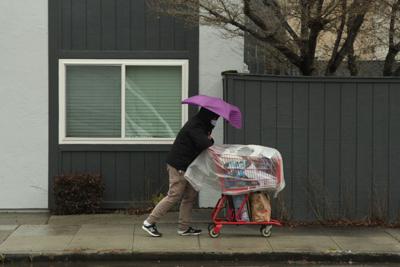

Any local will tell you it’s always windy in May and June, but is it getting windier? And why?
The short answer to both is yes, and it’s mainly a battle between competing pressure systems as the summer gets geared up.
Climate change may have something to do with the increased wind, but climate experts aren’t sure. What is known is that May and June are definitely windier than other months. Over a 20-year period, average speeds in May and June were 14.4 mph. December’s average is half that at 7.27 mph and September’s average is 11.59 mph, based on data collected through Iowa State University, partners of the National Weather Service.
Storms are more common in winter, so why is late spring windier? Much of it has to do with competing pressure systems, according to National Weather Service experts.
Warren Blier, NWS science and operations office, said the late spring wind can be attributed to the warm weather in the Central Valley and the cool sea breeze off the coast.
“It is sort of like a tug-of-war effect, the Central Valley warms up from the blazing sun and it creates low pressure that pulls in high pressure coastal breezes through the county,” Blier said.
As a result, offshore wind can become stronger in the late afternoon and evening, he added. And that is why San Francisco’s weather tends to be warmer in September than it is in June because the pull from the low pressure system inland can bring in the low fog clouds, Blier said.
Recommended for you
The Bayside around San Francisco International Airport is also known for its wind that is boosted by the San Bruno gap, the space between San Bruno Mountain and South San Francisco, as it comes in from the north.
While the average wind speed has reached or surpassed in four of the last six years, experts aren’t sure but believe temperatures are rising because of climate change and it ultimately affects these kinds of weather patterns.
June 21 marks the summer solstice as the first day of summer and it results in the longest day of the year for the Northern Hemisphere. Blier said when solstice occurs it means the Earth axis is tilted toward the sun, which is why the temperatures can be so warm.
“After the summer solstice, it starts to gradually taper off and by September the Central Valley isn’t heating up as much and the sea breeze tends to become much weaker because there isn’t as much heating inland,” Blier said.
While the beginning of the week was fairly windy, the breeze tapered off by Wednesday, NWS Meteorologist Dial Hoang said. On Tuesday, it rained 1/100 of an inch through the county and Hoang said he doesn’t expect it to rain again until later this weekend or early next week.
“There are no major storm systems but there’s a 30% to 40% chance that it will rain this upcoming weekend and early next week,” Hoang said.
However, he anticipates it to be fairly low amounts of precipitation. Temperatures throughout the week are expected to hover around the mid-60s by the San Francisco International Airport, the coast and higher elevations. In Redwood City, temperatures are expected to be in the 70s.


(0) comments
Welcome to the discussion.
Log In
Keep the discussion civilized. Absolutely NO personal attacks or insults directed toward writers, nor others who make comments.
Keep it clean. Please avoid obscene, vulgar, lewd, racist or sexually-oriented language.
Don't threaten. Threats of harming another person will not be tolerated.
Be truthful. Don't knowingly lie about anyone or anything.
Be proactive. Use the 'Report' link on each comment to let us know of abusive posts.
PLEASE TURN OFF YOUR CAPS LOCK.
Anyone violating these rules will be issued a warning. After the warning, comment privileges can be revoked.