
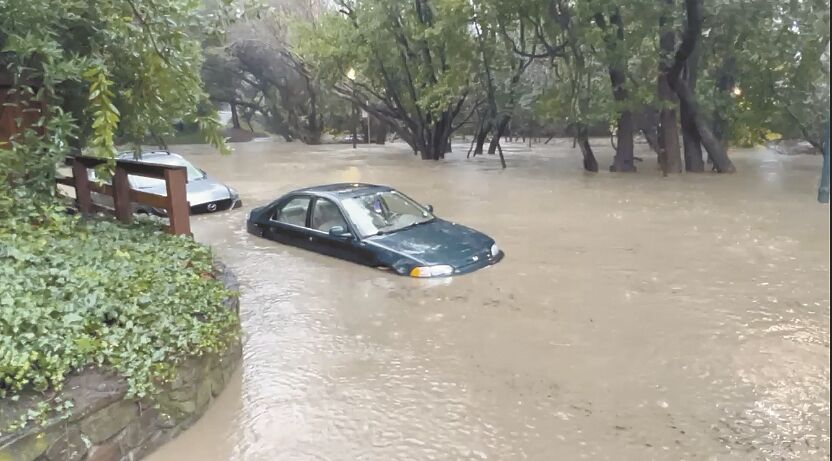
Another atmospheric river is expected to wash over the Bay Area this weekend, bringing significant risks of flooding in coastal areas and in some riversheds.
Forecasters with the National Weather Service’s Bay Area office said steadier rain arrives on Saturday. Most of the nine-county Bay Area could receive 3-4 inches of rain through Monday.
The North Bay and Santa Cruz and Monterey counties face the highest risk of flooding, high winds and high surf with waves of 20-25 feet during the storm, according to the weather service, as both areas are forecasted to receive between 4 and 6 inches of rain along the coast and at higher elevations.
Most of the rain, Saturday, will fall in a roughly six-hour window, according to forecasters, before giving way to showers Saturday night and into Sunday. A second storm system is then expected to pass over the region Sunday evening into Monday.
In San Mateo County, officials said the San Francisco Public Utilities Commission does not expect there to be spillover of the Crystal Springs Reservoir though at least Friday, Jan. 20. The reservoir is on the fuller side as the officials closed pipelines from the Hetch Hetchy Reservoir in Yosemite for maintenance, leaving the county to consume what water is currently stored in the Crystal Springs and San Andreas reservoirs. San Mateo Creek is fed from the Crystal Springs Dam off the Lower Crystal Springs Reservoir north of State Route 92. It runs through Hillsborough and San Mateo to the Bayshore. There was previous concern the heavy rain would require a spillover, which remains a slight possibility later in January, according to officials.
Elected officials are also working with Caltrans and other agencies to ensure work is being done to repair a sinkhole that forced the closure of State Route 92 and that emergency medical service and transportation is operational to coastside residents. The sinkhole is just east of where Pilarcitos Creek Road connects to State Route 92.
“I understand the impact of the closure on the residents that rely on the highway as a critical connection to the Peninsula. We have been in frequent communication with Caltrans, the California Highway Patrol, the affected cities, and the county. We will not let up until the road is repaired,” Assemblymember Marc Berman, D-Palo Alto, said. “Caltrans has assured me that they are working around the clock to reopen the road and inspect other roadways in the area for similar dangers. I will do everything in my power to ensure that this remains a top Caltrans priority.”
Berman is also working with state Sen. Josh Becker, D-San Mateo, and San Mateo County Supervisor Ray Mueller. The California Congressional Delegation and staff met with the leadership of CalOES and FEMA where both U.S. Reps. Anna Eshoo, D-Palo Alto, and Kevin Mullin, D-South San Francisco, underscored to the agency’s leadership the critical need to reopen State Route 92 in both directions as soon as possible. FEMA confirmed the agency is working on a fix.
In Monterey County, as a result of the rain and subsequent flooding of the Salinas River, parts of the county could be cut off and effectively turned into an island for two to three days, according to county officials.
Recommended for you
While the county’s bridges in the Salinas River basin are not expected to be at risk of severe damage during the storm, roads approaching the bridges, low-lying intersections and local surface streets could be flooded through Sunday night.
According to Monterey County’s Department of Emergency Management and the county Sheriff’s Office, flooding is expected on state Highway 68, River Road, Reservation Road, Blanco Road, several secondary roads and possibly state Highway 1.
Evacuation orders are already in effect for low-lying areas along the Salinas River from north of Highway 68 to the coast. Evacuation order information for Monterey County can be found at https://bit.ly/3Za0Xc0.
Wind gusts of up to 45 mph are also possible throughout most of the Bay Area during the weekend, with more intense gusts likely at higher elevations.
As a result, falling debris, downed power lines and downed trees are once again expected to threaten human life throughout the storm’s duration.
The weather service has placed the entire Bay Area and Central Coast under a flood watch from 4 a.m. Saturday through Monday afternoon. Coastal areas are also under a High Surf Warning through 10 a.m. Saturday.
Showers could continue early next week, according to forecasters, before a high-pressure system moves into the area next weekend that should bring warm and dry weather.
Go to sfpuc.org/PeninsulaReservoirWetWeather for more information about the Crystal Springs Reservoir wet weather operations. Go to smcalert.info to sign up for SMC Alerts.


(0) comments
Welcome to the discussion.
Log In
Keep the discussion civilized. Absolutely NO personal attacks or insults directed toward writers, nor others who make comments.
Keep it clean. Please avoid obscene, vulgar, lewd, racist or sexually-oriented language.
Don't threaten. Threats of harming another person will not be tolerated.
Be truthful. Don't knowingly lie about anyone or anything.
Be proactive. Use the 'Report' link on each comment to let us know of abusive posts.
PLEASE TURN OFF YOUR CAPS LOCK.
Anyone violating these rules will be issued a warning. After the warning, comment privileges can be revoked.